|
Index...
|
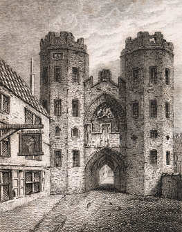
 significant length of wall, uninterrupted except for a single postern (or secondary) gate, led north west from Cheylesmore to what was probably the grandest out of all the gates.... Spon Gate (originally known as Bablake gate).
This old engraving on the left depicts the complex structure which stood proudly alongside St. John's church at the end of Spon Street. The image was engraved by J. Greig from a drawing by J. Smith, and was published on the 1st July 1817. The view is of the outside of the gate from Spon Street looking in towards the town. St. John's church would be through the gate and on the left.
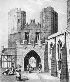
The lithograph on the right was made by Miss Eld and published by C. A. N. Rollason in 1840. It depicts the inside of Spon Gate and shows its close proximity to St. John's church, then known as Bablake church.
At the time the building of the wall was commenced, Spon Street was the name given to the whole length of road to the west of its junction with Hill Street and Smithford Street. However, sometime between 1411 and 1434, the short piece of road leading up to the 'inside' of the gate was renamed "Fleet Street".
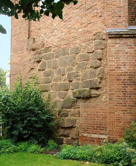
 n the immediate west side of St. John's Church another piece of wall has been put to good use as part of the structure of number 190 Spon Street....
This is the first piece of wall that we've see since we came from across the other side of the town near to New Gate, the previous mile or so of city wall and the five grand gates protecting the south side of Coventry being completely destroyed.
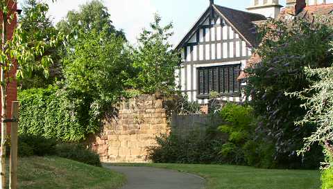
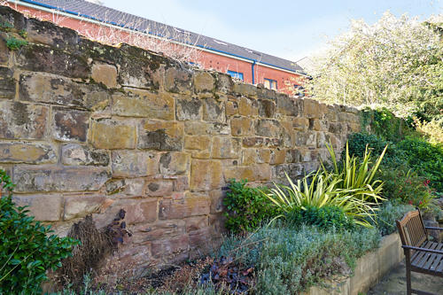
The next piece of wall is very close by and can be viewed from the junction of Fleet Street and Lower Holyhead Road through some railings. This is at the rear of Bond's Hospital and is pictured below.
In September 2019 I was privileged to be allowed into the garden at Bond's Hospital to be able to photograph that part of our ancient City Wall from the inside.
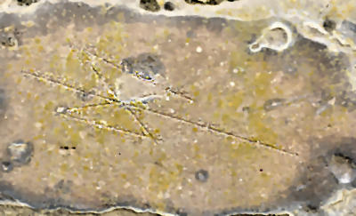
Still clearly visible on one of the sandstone blocks is the mark left by a stone mason over 600 years ago, in the shape of a double-headed axe. It's the little details like this that bring those medieval workers closer to us.
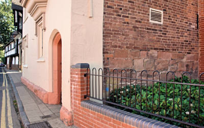
As you cross over from Bond Street to the other side of Hill Street, you will arrive at Bond's Hospital. On the north side of the building (to your right) it appears that some stones from the old wall have been re-used in the structure of the almshouse. This is not the original line of the wall, however, as this northern wing of Bond's Hospital was not built until 1816.
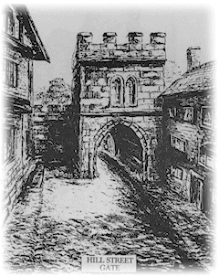 Hill Street Gate by Coventry artist, David Hale. (This image must not be copied or reproduced in any way without permission from the artist.)
 he David Hale illustration on the right is a northwards looking view of the "town" side of Hill Street Gate. The building on the left is Bond's Hospital.
It is worth noting, however, that the modern-day markings in the road for Hill Street gate are no longer in the correct location. Until 2015 the gateway was marked correctly, directly in line with Bond Street. This Google Street View has captured the 2015 view. As might be noticed, though, the road surface was in need of repair, but on completion the representation of the gateway in red brick was moved a few metres north.
Website by Rob Orland © 2002 to 2026