|
Index...
|
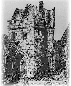 New Gate by Coventry artist, David Hale. (This image must not be copied or reproduced in any way without permission from the artist.)
 ew gate would have stood approximately on the centre reservation where the London Road sweeps round to meet the Ring Road. Originally, before the Ring Road was built, London Road was simply a continuation of Much Park Street, and had been such for virtually as long as Coventry has existed, as can be seen on my maps page. In the background can be seen Whitefriars monastery.
On the right is an impression of New Gate, which was the main exit from Coventry as you left for London. This was the very first gate to be built as the town wall was begun in 1356.
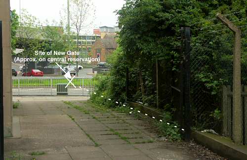
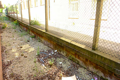
The photograph above shows the line of the wall from the northern direction, with the location of New Gate indicated. This rather unsubstantial piece of town wall is near to Parkside, and ran directly southwards from the gate before turning sharply west towards the Little Park gate. In the photo below there is unfortunately not much wall visible, but sits largely hidden under the concrete plinth below the chain-link fence.
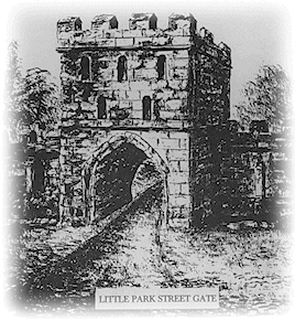 Little Park Gate by Coventry artist, David Hale. (This image must not be copied or reproduced in any way without permission from the artist.)
 fter New Gate the wall continued roughly south for around 60 metres where, at a five-sided tower, it turned to the west and headed towards Little Park gate, unsurprisingly found at the end of Little Park Street, which was literally that - the entrance to the 'little park' that lay next to the great park which was originally reached by way of Much Park Street. It all makes sense, really!
The 1851 Board of Health map show that the quarter-mile stretch of wall running east-west alongside Parkside, and beyond Little Park gate to Cheylesmore gate, was still to be seen, albeit in a ruinous state.
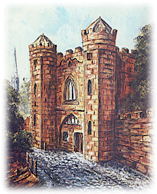 Cheylesmore Gate by Coventry artist, David Hale. (This image must not be copied or reproduced in any way without permission from the artist.)
Unfortunately, the whole mile or so of city wall, from Parkside all the way to Spon Street in the west, now leaves nothing behind for us to see. The foundations of probably nearly the whole town wall still lie below the various modern day developments, but the southern length of our defence has virtually disappeared from view.
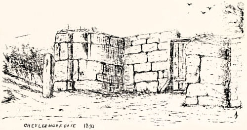
After Little Park gate we come to Cheylesmore Gate, which stood only 70 metres to the west - a gateway which gave entrance to the manor and stood next to what is now St. Patrick's Road.
The sketch below was made by antiquarian W.G. Fretton in 1870, and shows that even at that late date we were still able to visit the remains of Cheylesmore Gate, which included the slide of the portcullis and several courses of stone slowly decaying.
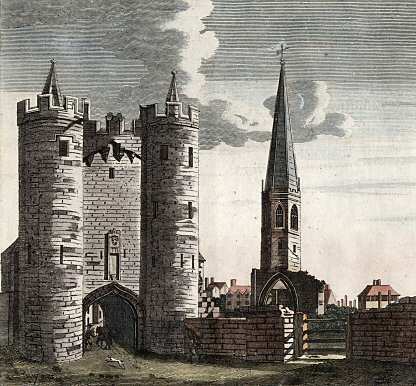
 he next gate in our tour is Greyfriars Gate, which would have stood between the bottom of the modern day Hertford Street and Warwick Row.
This beautiful engraving on the left, which must have been made shortly before the gate was demolished in October 1781, shows the exterior view of the once formidable fortification falling into decay adjacent to the lonely spire of the former Greyfriars church, which fell at the dissolution. The smaller illustration shows how it would have appeared to citizens inside the wall.
Website by Rob Orland © 2002 to 2026